In this guide
💡 The Short Version: Purchase a T-money card (₩4,000–₩5,000) or a tourist Climate Card (from ₩5,000/day) upon arrival, and reload it with cash banknotes; station machines and convenience stores do not accept foreign credit cards for transit top-ups. Subway rides start at ₩1,550 with a card (₩1,650 for single cash tickets), with free transfers to city buses within 30 minutes. Download Naver Map in English before your journey, as Google Maps does not give turn-by-turn walking directions in South Korea. Never sit in the designated priority seats at the ends of subway cars, even on packed trains. Or book ahead: pre-ordering a T-money Card on Klookad{rel=“sponsored nofollow noopener”} lets you collect your transit card at the airport without queuing at convenience stores.
The Seoul Metropolitan Subway network
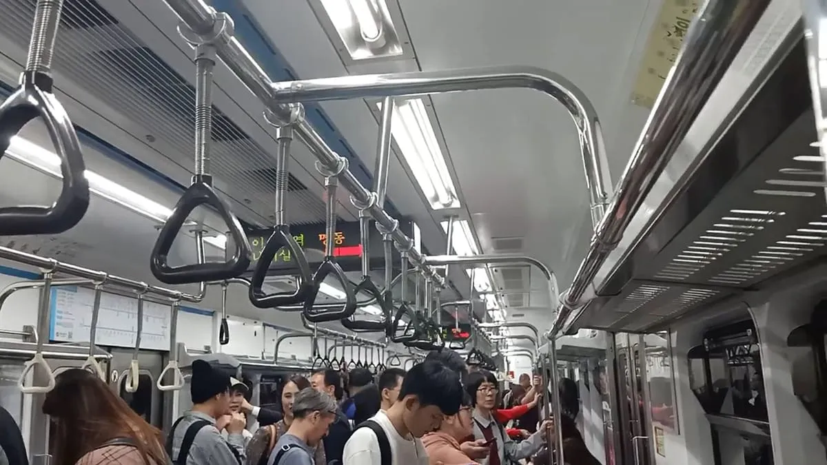
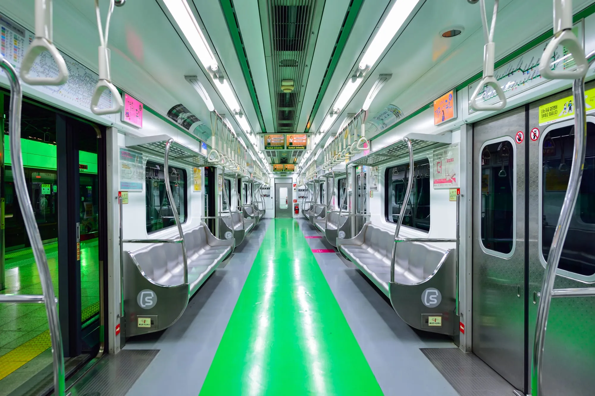
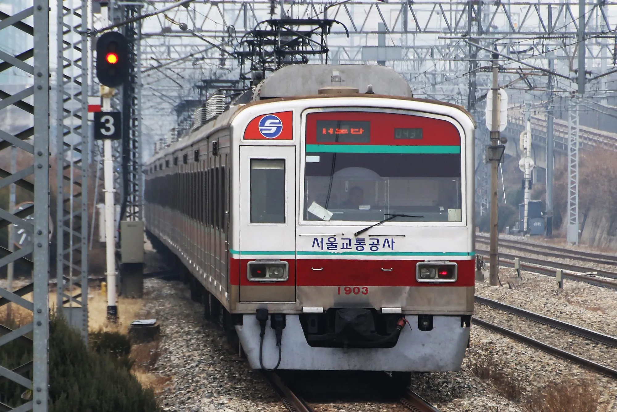
Seoul possesses an extensive, punctual urban rail network. Spanning 23 lines across greater Seoul, Incheon, and Gyeonggi province, the system carries millions of daily passengers with full English signage, multi-language audio announcements, platform screen safety doors, and heated carriage seats in winter.
- Operating hours: Trains run from approximately 05:30 in the morning until around 24:00 (midnight) daily. Last trains depart city centres between 23:45 and 24:10 depending on the line and day of the week.
- Frequencies: Trains run every 2 to 4 minutes during morning and evening rush hours (07:30 to 09:00 and 17:30 to 19:30), and every 4 to 8 minutes during daytime off-peak hours.
- Base fares:
- Standard contactless transit card (T-money or Climate Card): ₩1,550 base fare on seoulmetro.co.kr covering up to 10 kilometres.
- Single-journey cash ticket: ₩1,650 base fare, plus an upfront ₩500 refundable deposit card fee that must be retrieved at a deposit return machine at your exit station.
- Distance surcharges: ₩100 per 5 km for distances between 10 km and 50 km; ₩100 per 8 km beyond 50 km.
Key subway lines for visitors
| Subway Line | Colour | Core visitor stations | What it connects |
|---|---|---|---|
| Line 1 | Dark Blue | Seoul Station, City Hall, Jongno 3-ga, Dongdaemun, Cheongnyangni | Historic city corridor, KTX trains, wholesale markets, day trips north and south |
| Line 2 | Green (Circle) | Hongik Univ (Hongdae), City Hall, Euljiro, Dongdaemun (DDP), Gangnam, Jamsil | Circular central loop linking university neighbourhoods, business towers and Lotte World |
| Line 3 | Orange | Gyeongbokgung, Anguk, Jongno 3-ga, Express Bus Terminal, Sinsa, Apgujeong | Heritage district (palaces, Bukchon, Insadong) direct to southern shopping avenues in Gangnam |
| Line 4 | Light Blue | Myeongdong, Seoul Station, Hoehyeon (Namdaemun), Dongdaemun, Ichon | Shopping quarters, national railway hub, National Museum of Korea, transfer to N Seoul Tower |
| Line 5 | Purple | Gimpo Airport, Yeouido, Gwanghwamun, Jongno 3-ga, Dongdaemun DDP | Financial district, government square, direct link from western Gimpo Airport to old centre |
| Line 9 | Gold | Gimpo Airport, Yeouido, Express Bus Terminal, Sinnonhyeon (Gangnam), Olympic Park | Features Express trains saving 20 minutes between Gimpo, Yeouido and Gangnam |
| Shinbundang | Red | Gangnam, Yangjae, Pangyo, Jeongja, Gwanggyo (Suwon) | High-speed automated line into southern tech hubs; carries a separate private line surcharge |
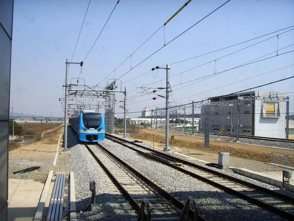
| AREX | Cyan | Incheon Airport T2/T1, Gimpo Airport, Hongik Univ (Hongdae), Seoul Station | Dedicated airport corridor covered in our Seoul airport to city guide |
Transit cards compared: T-money vs Climate Card
Visitors travelling around Seoul primarily choose between two smartcard options: a pay-per-ride T-money card or an unlimited Climate Card.
| Feature | T-money / Cashbee Card | Climate Card (Tourist Pass) |
|---|---|---|
| Initial card purchase fee | ₩4,000 to ₩5,000 (blank physical card) | ₩3,000 (blank tourist physical card) |
| Usage model | Pay-per-journey debit balance deducted on tap | Unlimited rides for selected calendar duration |
| Pass prices | Load variable cash amounts (e.g. 10,000–₩30,000) | 1-day: ₩5,000 / 2-day: ₩8,000 / 3-day: ₩10,000 / 5-day: ₩15,000 / 7-day: ₩20,000 |
| Subway network coverage | All subway lines across South Korea | Seoul-operated subway lines (Lines 1–9, Sillim, Ui-Sinseol) within Seoul boundaries |
| Shinbundang Line included? | Yes (standard fare plus distance/line surcharge) | No (Shinbundang Line is strictly excluded) |
| AREX rail coverage | Covers both All-Stop and Express (Express requires separate ticket purchase) | Covers All-Stop train only within Seoul (Gimpo Airport to Seoul Station; cannot exit at Incheon Airport) |
| City bus coverage | All city, village, provincial and express buses nationwide | Seoul-licensed Blue, Green, Yellow, and Maeul buses only |
| Suburban Gyeonggi buses? | Yes | No (red intercity and Gyeonggi buses not covered) |
| Taxi and convenience stores? | Yes (can pay for retail goods and taxi fares) | No (strictly transit rides on covered network) |
| Nationwide validity | Yes (Busan, Jeju, Daegu, Gyeongju, Sokcho) | Strictly restricted to the Seoul metropolitan boundary |
Understanding the Climate Card (Gihu Donghaeng Card)
The Climate Card was introduced by the Seoul Metropolitan Government to promote public transit use. For travellers taking 4 or more subway or bus trips per day, the savings accumulate quickly:
- Where to buy: Physical tourist Climate Cards are sold for ₩3,000 at Seoul Metro Customer Service Centres (Lines 1 to 8) and designated convenience stores adjacent to stations.
- How to activate: Take your physical Climate Card to an automated ticket vending machine inside any Seoul Metro station, place it on the reload scanner, select “Climate Card”, choose your duration (1, 2, 3, 5, or 7 days), and insert KRW cash banknotes. The validity period starts immediately on the calendar day of purchase.
- Important boundary rule: You can board a subway train within Seoul using your Climate Card, but if you ride outside the Seoul boundary (for example, to Suwon, Incheon Airport, or Everland), the exit turnstile will display an error code and reject your card. A station attendant will have to manually calculate your fare from your entry station, charge you the cash difference, and reset your card.
Understanding the T-money Card
If your trip includes travel outside Seoul, check train fares on Korail; the standard T-money card remains the most flexible choice:
- Universal utility: Works on all subways, local buses in every Korean city, highway tollgates, and city taxis. You can also pay for snacks, drinks, and incidentals at convenience stores (GS25, CU, 7-Eleven, Emart24).
- Reloading rules: Physical T-money cards must be reloaded with cash banknotes at station vending machines or convenience store registers. Foreign credit cards, debit cards, Apple Pay, and Google Pay cannot be used to reload transit cards.
- Transfer discount system: When you tap off a subway and tap onto a city bus within 30 minutes (or vice versa), the second leg is completely free or charged only the marginal distance increment. You can make up to 4 consecutive transfers within the 30-minute transfer window. Always tap both on entry and exit to validate the transfer discount.
[!TIP] The Discover Seoul Pass comes with an embedded physical T-money chip. Even after the pass’s attraction entry hours expire, the physical card functions permanently as a standard T-money card whenever loaded with cash.
Seoul city bus colours explained
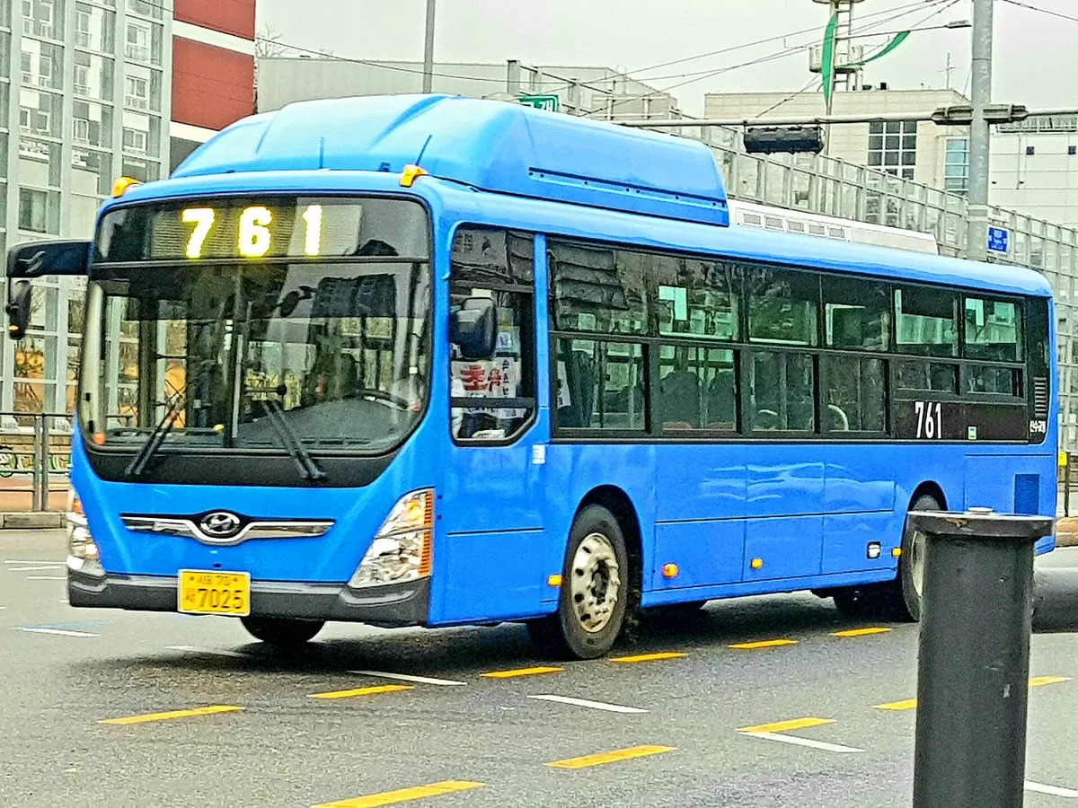
Seoul operates an efficient fleet of over 7,000 city buses coordinated by TOPIS running in dedicated centre-lane bus corridors that bypass surface car traffic. Buses are colour-coded based on their operational category:
| Bus colour | Category | Route numbers | Base adult fare | Function and characteristics |
|---|---|---|---|---|
| Blue | Trunk (Ganseon) | 3 digits | ₩1,500 | Major arterial routes connecting outer residential districts directly to downtown Seoul along dedicated bus lanes |
| Green | Branch (Jiseon) & Village (Maeul) | 4 digits (Maeul: district name + number) | ₩1,500 (Maeul ₩1,200) | Feeder buses connecting residential neighbourhoods, alleys and hills to nearest subway stations and trunk corridors |
| Red | Metropolitan Express (Gwang-yeok) | 4 digits (starts with 9) | ₩3,000 | Fast commuter coaches linking Gyeonggi satellite towns (Bundang, Ilsan, Suwon, Yongin) directly to central Seoul |
| Yellow | Circular (Sunhwan) | 2 digits | ₩1,400 | Downtown circulators linking major sights, business and shopping spots (e.g. Namsan Circular Shuttle Bus 01 to N Seoul Tower) |
| Night (N) | Late-Night (Olbaemi) | Prefix ‘N’ + 2 digits (e.g. N15, N16) | ₩2,500 | Operates between 23:30 and 04:30 along major nightlife and transit corridors after subways shut down |
- Boarding and alighting: Always board through the front doors and tap your card on the sensor. Exit through the rear doors and tap your card on the rear exit scanner before stepping off. Tapping out is essential to secure your transfer discount and avoid maximum-fare distance penalties.
- Announcements: Audio announcements in Korean and English announce the upcoming stop, followed by the subsequent stop: “This stop is City Hall. The next stop is Jonggak.”
Subway carriage etiquette
Seoul subway etiquette is strictly observed by commuters. Following standard rules ensures a smooth trip:
- End-of-carriage priority seats: The three-seat rows at both far ends of every carriage are designated for the elderly, disabled, injured, and pregnant women. These seats are left vacant even on packed peak-hour trains where dozens of passengers are standing. Foreign travellers should avoid sitting in these seats under any circumstance.
- Pink pregnant-passenger seats: Located in the middle of train carriages marked with a pink floor sticker and seat cover. These should be left unoccupied for expecting mothers.
- Yellow queuing markers: On subway platforms, queue behind the painted yellow floor markings to the left and right of the sliding platform doors. Never stand directly in the centre, allowing alighting passengers to exit fully before stepping aboard.
- Escalator conventions: When riding escalators at stations, stand on the right side if resting, leaving the left side unobstructed for passengers walking or hurrying to catch a connection.
- Quiet carriages: Commuters keep mobile phones set to silent mode (manner mode). Making voice telephone calls is discouraged, and watching video content without headphones is considered antisocial.
- Rucksacks on crowded trains: On crowded commuter trains, take off heavy rucksacks and hold them by your feet or place them on the overhead wire luggage racks to avoid bumping seated passengers.
Why you need Naver Map or KakaoMap
Navigating Seoul on foot requires local Korean navigation software.
- Google Maps limitations: Google Maps shows station locations and public transport routes, with walking legs drawn as dotted lines, but gives no turn-by-turn walking directions. Google has said it plans to add them and has given no launch date. In the alleys of Insadong, Myeongdong or Bukchon, use Naver Map or KakaoMap.
- Naver Map (Recommended):
- Fully translated into English, Chinese, and Japanese.
- Generates accurate step-by-step pedestrian walking routes with incline gradients, stairs, and crosswalk details.
- Displays real-time bus countdown timers (telling you exactly how many minutes and stops away your bus is).
- Shows which subway car number to board (e.g. “Car 4-2”) to be directly aligned with transfer escalators at your interchange station.
- Features street view imagery (Panorama) to preview building entrances.
- KakaoMap:
- Clean English interface with building layouts and transit routing.
[!TIP] Download Naver Map before landing. Set up a Naver account to bookmark and organise your hotel, saved restaurants, palace gates (like Gyeongbokgung and Changdeokgung), and major sights into custom colour-coded lists.
Step-by-step: taking your first subway journey
- Locate your station entrance: Look for the vertical Seoul Metro pole displaying the station name in Korean and English, the station number (e.g. “202” for Euljiro 1-ga), and the coloured line icon.
- Ensure card balance: Check that your T-money card has at least ₩1,550, or tap your active Climate Card. If purchasing a single ticket, select English at the automated machine, choose your destination station, insert cash banknotes, and take your blue ticket card.
- Pass the turnstile: Tap your card against the scanner on top of the right-hand turnstile bar. The sensor will beep, display your remaining card balance, and release the gate.
- Follow the directional line colours: Overhead directional boards display the line colour and the terminal direction station. Check the preceding and succeeding station numbers to verify you are heading in the correct direction.
- Board behind the yellow line: Wait on the platform markings until departing passengers have fully alighted down the centre.
Common questions
How much does a subway ride cost in Seoul?
The base adult subway fare in Seoul is ₩1,550 on Seoul Metro using a T-money card or credit card for distances up to 10 kilometres. Beyond 10 km, an extra ₩100 is added per 5 km. Single cash tickets cost ₩1,650 plus a ₩500 refundable card deposit.
Can I reload a T-money card with a foreign credit card?
No. Subway station reload kiosks and convenience store cashiers in South Korea only accept cash in won banknotes to reload physical T-money and Climate Cards. You must carry local cash.
What is the Climate Card and does it cover all trains?
The Climate Card (Gihu Donghaeng Card) is an unlimited transit pass for Seoul, priced at ₩5,000 for 1 day, ₩8,000 for 2 days, ₩10,000 for 3 days, ₩15,000 for 5 days, and ₩20,000 for 7 days (plus ₩3,000 for the physical card). It covers Seoul municipal subway lines and city buses. It does not cover the privately run Shinbundang Line, suburban buses, or stations outside Seoul such as Suwon, Everland or Incheon Airport.
What do the different bus colours mean in Seoul?
Blue buses are trunk routes connecting major suburban corridors to downtown along bus-only lanes. Green buses are branch routes feeding residential areas into subway stations. Red buses are express commuter services connecting Gyeonggi satellite towns to Seoul. Yellow buses operate circular loops around central commercial districts.
Why should I use Naver Map instead of Google Maps in Seoul?
Google Maps in South Korea shows transit routes and place details but not turn-by-turn walking directions; Google has said it plans to add them and has given no launch date. Naver Map and KakaoMap provide English navigation, exact pedestrian paths, live bus arrival times, and subway carriage recommendations for quick transfers.