In this guide
💡 The Short Version: The South Coast (Suðurland) is Iceland’s most visually driving corridor, following Route 1 eastward from Reykjavik to Vík í Mýrdal. The round-trip journey spans 372 kilometres and requires 10 to 12 hours. Headline stops include Seljalandsfoss (a 60-metre waterfall you can walk behind), Skógafoss (a thunderous 60-metre water curtain with a 527-step staircase), the Sólheimajökull glacier tongue, and the black volcanic sand and basalt columns of Reynisfjara. Self-driving incurs approximately 3,650 ISK in parking fees across the main car parks. Or book a tour: eliminate 5.5 hours of sub-arctic driving and navigate winter weather safely by booking GetYourGuide’s South Coast Waterfalls, Black Sand & Glacier Tourad.
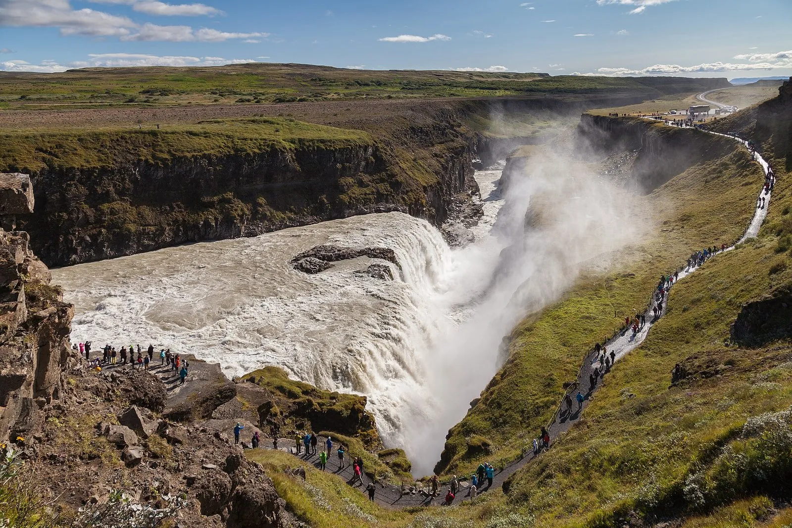
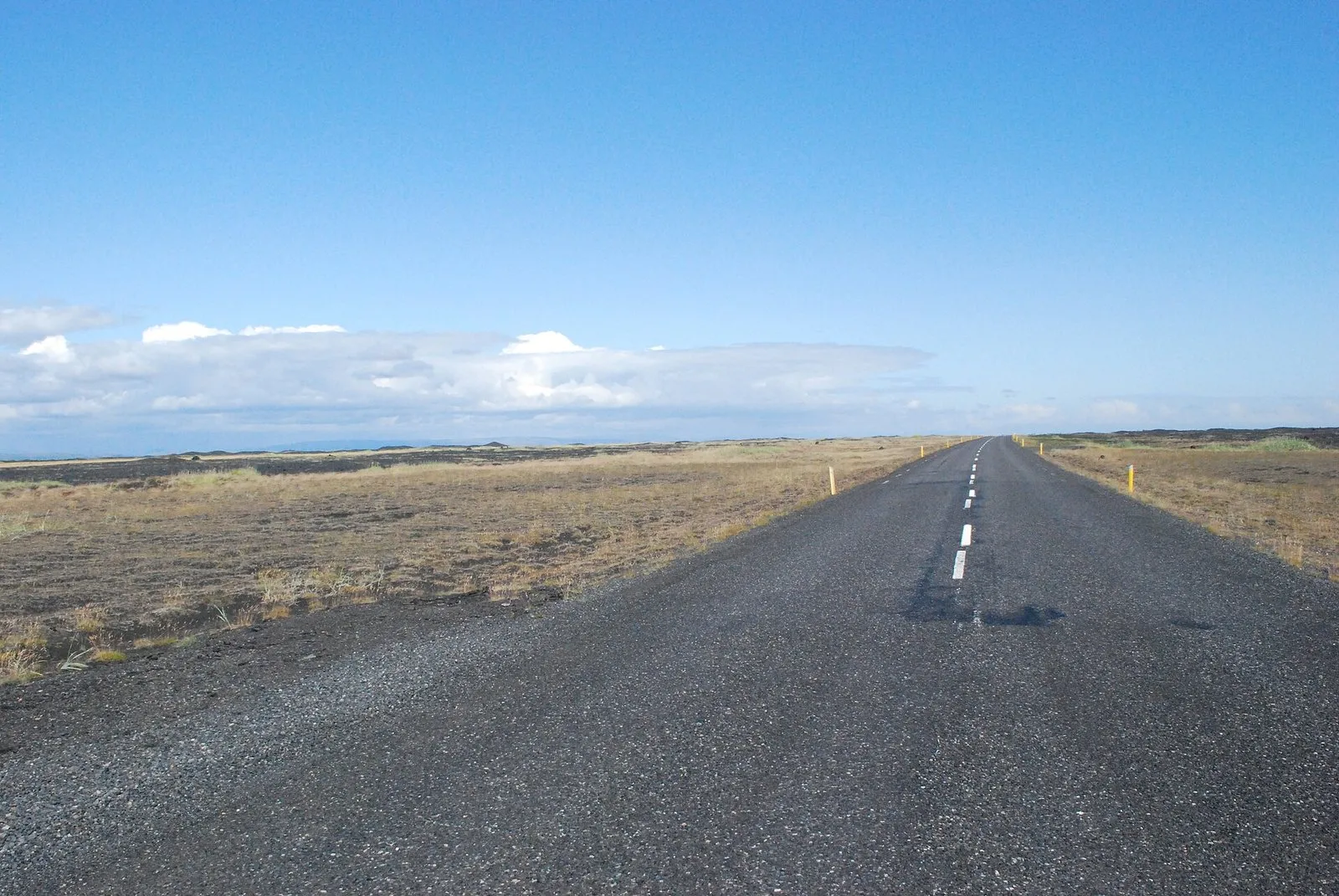
Framed between the roaring North Atlantic Ocean to the south and towering sub-glacial volcanoes to the north—including the notorious Eyjafjallajökull and Katla—the southern lowlands showcase Iceland’s raw geological power. Paved, flat, and well-maintained, Route 1 cuts across vast glacial outwash plains (sandur), passing roadside waterfalls, moss-covered volcanic lava fields, and rugged coastal cliffs.
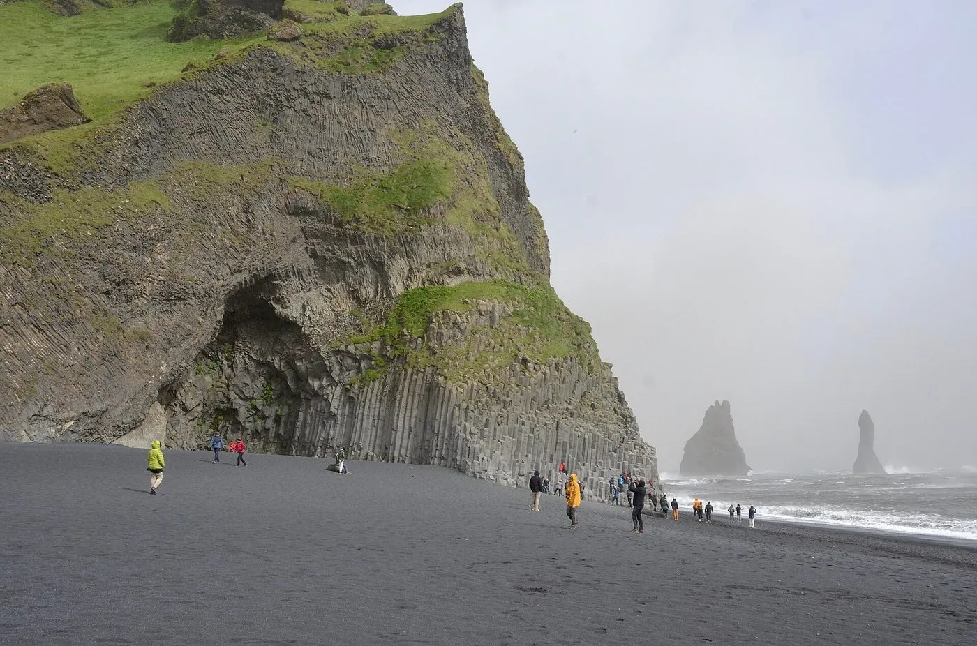 Hálsanefshellir cave and the Reynisdrangar sea stacks at Reynisfjara. Photo: Olga Ernst, Wikimedia Commons, CC BY-SA 4.0.
Route itinerary, stops and driving distances
While the Golden Circle forms a compact circular loop, the South Coast is a linear out-and-back journey along the Ring Road (Route 1). To maximise daylight and stay ahead of large coach tour convoys, aim to depart central Reykjavik by 07:30.
| Excursion stop | Distance from previous stop | Highway segment | Typical dwell time | Parking fee | Primary highlights |
|---|---|---|---|---|---|
| Seljalandsfoss & Gljúfrabúi | 127 km from Reykjavik | Route 1 | 1 to 1.5 hours | 900 ISK | Walk-behind waterfall, hidden canyon fall |
| Skógafoss Waterfall | 29 km from Seljalandsfoss | Route 1 | 1 hour | 1,000 ISK | 60 m cascade, 527 staircase steps, canyon view |
| Sólheimajökull Glacier | 12 km from Skógafoss | Route 221 off Route 1 | 45 minutes | 750 ISK | Glacial lagoon, volcanic ash ice ridges |
| Dyrhólaey Peninsula | 18 km from Sólheimajökull | Route 218 off Route 1 | 45 minutes | Free | Natural sea arch, puffin nesting cliffs (summer) |
| Reynisfjara Black Beach | 15 km from Dyrhólaey | Route 215 off Route 1 | 1 hour | 1,000 ISK | Hexagonal basalt columns, Reynisdrangar sea stacks |
| Vík í Mýrdal | 10 km from Reynisfjara | Route 1 | 45 minutes to 1 hour | Free | Historic red-roofed church, dining, wool centre |
| Return to Reykjavik | 186 km from Vík | Route 1 west | 2.5 to 3 hours | None | Direct westward drive back through Selfoss |
Stop 1: Seljalandsfoss and the hidden Gljúfrabúi
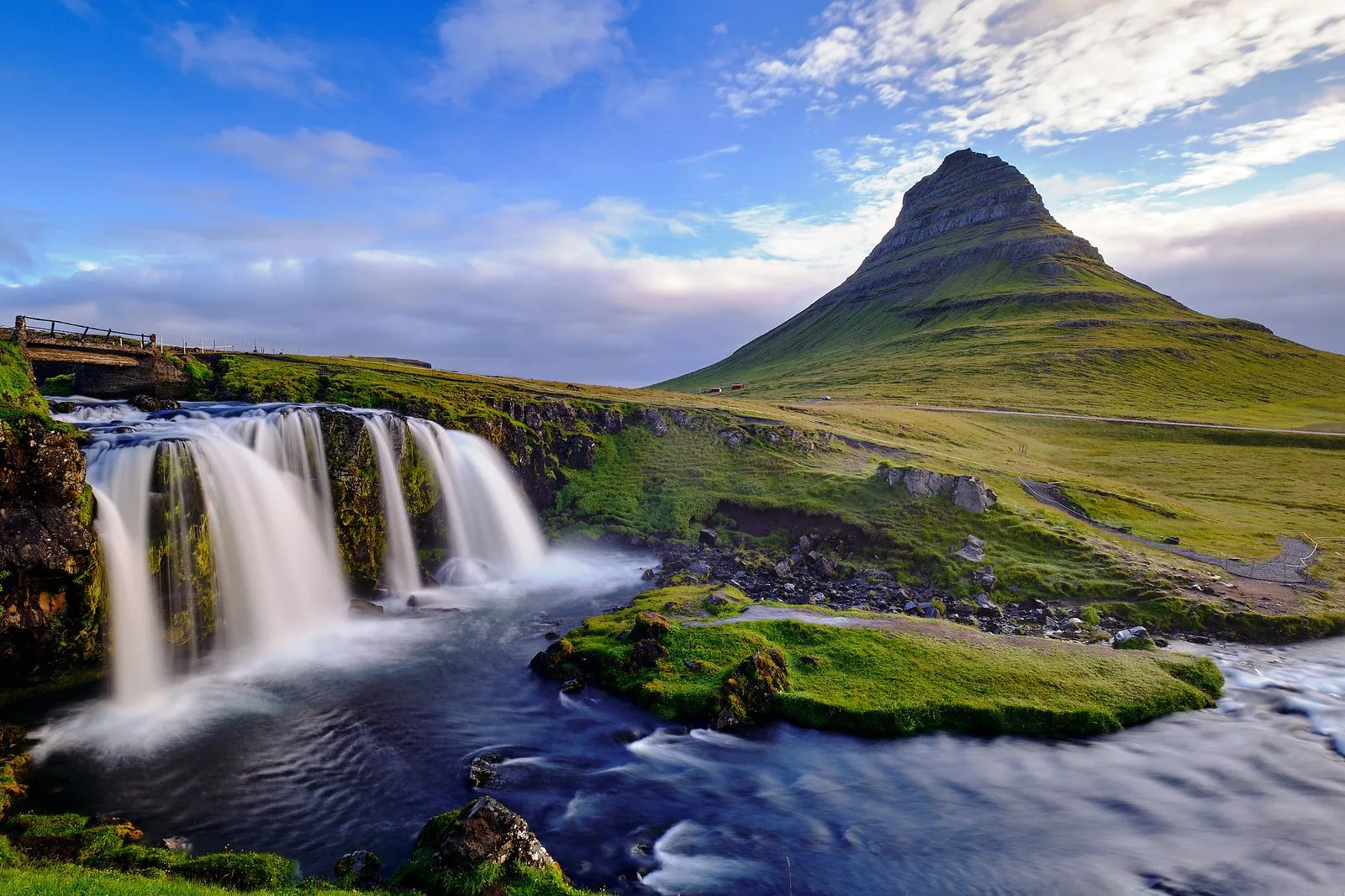
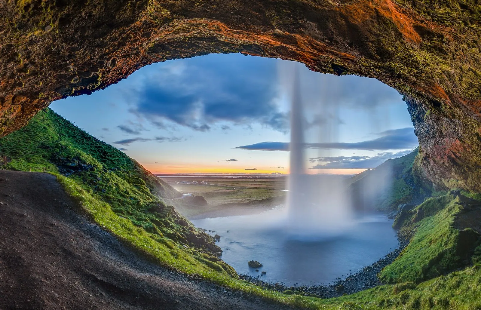
Plunging 60 metres over an ancient sea cliff, Seljalandsfoss is fed by meltwater originating on the Eyjafjallajökull ice cap. Its defining feature is a wide cavern hollowed out behind the cascading water sheet, allowing visitors to complete a 360-degree walking circuit around the waterfall.
Walking behind the cascade
The foot trail leads from the grassy meadows up a rocky ramp, passes directly behind the falling curtain of water, and descends via a stone staircase on the opposite flank. Because persistent mist whips off the pool, prepare for heavy spray:
- Stow electronic devices, cameras, and passports in waterproof dry bags.
- Wear a hooded waterproof jacket and rain trousers; umbrellas are completely useless in the updraft winds.
- During sub-zero winter temperatures, freezing spray coats the rocky trail in thick, hazardous glaze ice, prompting park rangers to chain off the rear trail for visitor safety.
Don’t miss Gljúfrabúi (The Canyon Dweller)
After viewing Seljalandsfoss, walk 500 metres north along the marked gravel cliff path to Gljúfrabúi. Partially concealed within a narrow rock chasm, this 40-metre waterfall drops into an enclosed subterranean chamber. To enter, you must step across slippery stepping stones submerged in the shallow stream running through the canyon gap. Inside, water crashes thunderously into a circular pool beneath a skylight in the rock ceiling.
Parking details: A fee of 900 ISK applies per passenger vehicle at the Seljalandsfoss car park. Pay on arrival using the Checkit.is portal or via the on-site automated kiosks.
Stop 2: Skógafoss Waterfall
Located 29 kilometres east along Route 1, Skógafoss is one of Iceland’s most symmetrical and imposing waterfalls. Spanning an impressive width of 25 metres with a vertical drop of 60 metres, the Skógá river discharges immense hydraulic force onto a flat pebble riverbed.
On bright, sunlit days, the thick cloud of airborne spray regularly produces vivid single and double rainbows arching across the green cliff face. You can walk right up to the base of the waterfall on the flat gravel apron, though the spray will soak you within 50 metres.
The 527-step staircase
On the right-hand flank of the waterfall, a well-maintained steel and timber staircase ascends 527 steps to a cantilevered metal viewing platform perched over the lip of the falls. The platform delivers sweeping panoramic vistas down the Skógá river plain toward the North Atlantic shoreline.
From the top platform, a trail leads inland along the river gorge into Waterfall Way (Fossaslóð), which passes more than 20 secluded upper cascades along the beginning of the famed Fimmvörðuháls wilderness trail toward Þórsmörk.
Parking details: Parking at Skógafoss costs 1,000 ISK per car, payable through the Parka.is smartphone application or website.
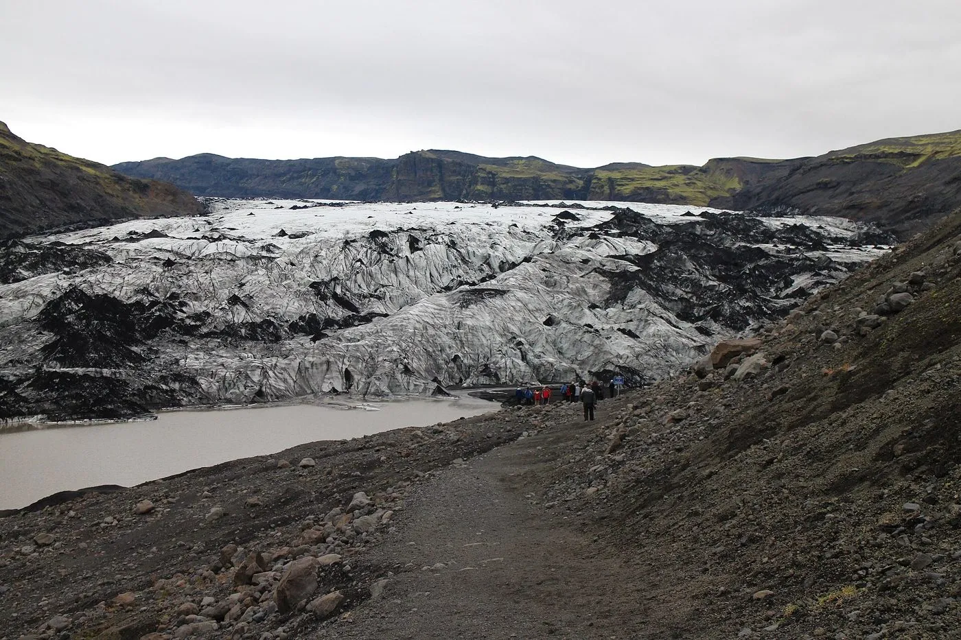 The Sólheimajökull glacier tongue. Photo: Dirk Schmidt, Wikimedia Commons, CC BY-SA 3.0.
Stop 3: Sólheimajökull Glacier Tongue
Branching off the massive Mýrdalsjökull ice cap—which conceals the restless Katla volcano beneath hundreds of metres of solid ice—Sólheimajökull is an eight-kilometre-long outlet glacier tongue.
A 15-minute walk from the car park on Route 221 brings you to the shore of a milky glacial lagoon filled with detached blue icebergs. The ice face exhibits distinct alternating bands of translucent blue compression ice and black volcanic tephra, deposited during historic eruptions of Katla and Eyjafjallajökull.
Glacier safety rules: Never step onto the glacier ice without professional guiding equipment. Deep crevasses (sprungur), fragile moulin sinkholes, and collapsing terminal ice walls make unguided glacier walking exceptionally dangerous. If you wish to hike across the ice ridges, book a guided glacier trek where certified guides supply steel crampons, harnesses, and ice axes.
Parking details: 750 ISK per vehicle, payable via the Parka app.
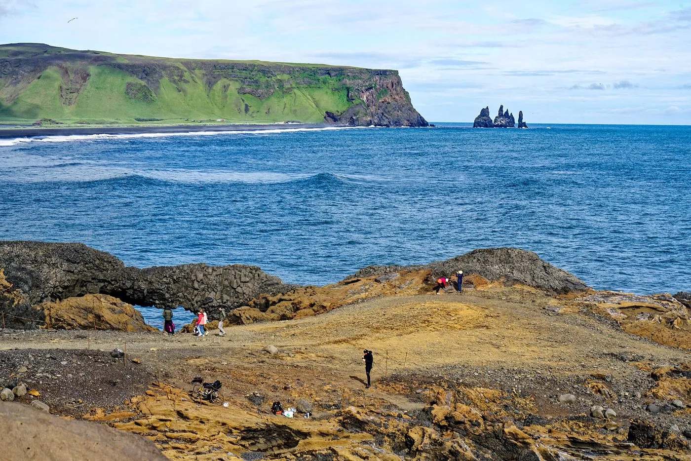 Dyrhólaey and its rock arch. Photo: Holger Uwe Schmitt, Wikimedia Commons, CC BY-SA 4.0.
Stop 4: Dyrhólaey Promontory
Rising 120 metres above the sea, Dyrhólaey (Door Hill Island) is a volcanic headland formed during an ancient submarine eruption. The promontory is crowned by a historic 1927 concrete lighthouse and is known for its colossal natural basalt rock arch, large enough for small boats (and once even a stunt pilot) to navigate through.
From the high plateau, the view extends east over the black sands of Reynisfjara and west along an unbroken golden sandbar stretching 40 kilometres toward Eyjafjallajökull. Between May and mid-August, the sheer grassy cliff faces host thousands of nesting Atlantic puffins (fratercula arctica). Puffin burrows sit along the top edges; visitors must stay strictly within the rope cordons to prevent collapsing the birds’ underground nests.
Visiting advice: The lower car park is accessible to all passenger cars; the steep upper road leading directly to the lighthouse is paved and open during daylight hours. Access is restricted during puffin breeding season in early May. Parking at Dyrhólaey is currently free of charge.
Stop 5: Reynisfjara Black Sand Beach
Recognised worldwide as one of the most striking non-tropical beaches on Earth, Reynisfjara features pitch-black volcanic gravel, towering hexagonal basalt columns at Garðar, the cavernous Hálsanefshellir sea cave, and the spiky Reynisdrangar offshore sea stacks jutting 66 metres out of the surging ocean surf.
According to ancient Icelandic folklore, the jagged sea stacks were once two fearsome trolls who attempted to drag a three-masted sailing ship to shore. Misjudging the passage of time, the trolls were caught by the first rays of dawn and petrified into solid basalt stone.
Critical safety rules: the sneaker wave hazard
Reynisfjara is one of Iceland’s most hazardous natural destinations. The seabed offshore drops off precipitously into deep water, allowing powerful oceanic storm swells generated across the southern oceans to race directly toward the shoreline without breaking on an outer sandbar.
These conditions create sneaker waves (drápsbylgjur): deceptively massive waves that surge dozens of metres further up the steeply sloping black sand than the preceding wave sets. Sneaker waves carry tremendous hydrodynamic force; they instantly sweep adult bathers off their feet and drag them into freezing undercurrents. Multiple fatal drowning accidents have occurred here.
An electronic hazard traffic light is situated beside the pedestrian pathway leading from the restaurant:
- Green Light: Normal safety conditions. Maintain standard vigilance and keep well back from the active surf.
- Yellow Light: Elevated hazard. Keep at least 15 to 20 metres back from the waterline. Under no circumstances step onto the basalt columns or venture near the mouth of Hálsanefshellir cave.
- Red Light: Extreme danger. Do not enter the beach gravel zone. Remain strictly within the elevated viewing platform by the restaurant.
- Fundamental Rule: Never turn your back on the ocean, even for a quick photograph.
Parking details: 1,000 ISK per car, payable through the Parka application.
Stop 6: Vík í Mýrdal
Positioned 186 kilometres east of Reykjavik, Vík í Mýrdal is Iceland’s southernmost mainland settlement, home to roughly 300 permanent residents. Standing beneath the steep escarpment of Mount Reynisfjall, the village is crowned by the red-roofed Víkurkirkja church, built in 1934 on high ground as an evacuation shelter in the event that a Katla eruption melts the Mýrdalsjökull glacier and triggers a catastrophic glacial outburst flood (jökulhlaup).
Vík serves as the commercial hub of the South Coast, offering petrol stations, electric vehicle fast chargers, outdoor gear outlets (Icewear and Katla Wool Studio), and relaxed dining options including Smíðjan Brugghús (artisan craft brewery and burgers) and Suður-Vík (local fish and lamb dishes).
Tour options and bookings
A guided excursion eliminates the exhaustion of driving 370 kilometres in changing sub-arctic weather conditions while ensuring expert navigation of regional safety hazards.
Reykjavik: South Coast Waterfalls, Black Sand & Glacier Tourad
From 16,500 ISK · 4.8 stars from 13,002 reviews · 10 hours · Instant confirmation
The benchmark full-day South Coast guided coach tour. Experience all the signature natural wonders: walk behind the veil of Seljalandsfoss, ascend the viewing staircase at Skógafoss, admire the glacier snout of Sólheimajökull, walk along the black sands of Reynisfjara under professional safety supervision, and visit the village of Vík. Features free Wi-Fi, audio commentary, and central bus stop pickups.
Reykjavik: South Coast Waterfalls & Glacier Small-Group Tourad
From 18,500 ISK · 4.8 stars from 860 reviews · 10 hours · Minibus
Travel in an intimate group of no more than 16 passengers aboard a high-comfort Mercedes Sprinter minibus. With a smaller group size, you spend less time waiting at photo stops and enjoy personalised historical commentary from a licensed local driver-guide.
Reykjavik: South Coast and Katla Ice Cave Small Group Tourad
From 32,600 ISK · 4.7 stars from 812 reviews · 10 hours · Ice cave gear included
The adventurous upgrade: combine the waterfalls of the South Coast with a Superjeep ride up the mountain slopes of Katla volcano. Venture inside a natural, iridescent blue-and-black sub-glacial ice cave within the Kötlujökull glacier, with safety helmets, headlamps, and microspikes provided.
Practical driving advice and winter considerations
- Departure Timing: During winter (November to February), daylight lasts only four to five hours. Set off from Reykjavik in total darkness around 07:30 so that you reach Seljalandsfoss just as the first morning twilight breaks around 10:00.
- Wind Hazards on Sandur Plains: The coastal lowlands around Eyjafjallajökull and Eldhraun are notorious for violent katabatic wind gusts funnelled through glacial valleys. If meteorological forecasts predict wind speeds exceeding 20 m/s (40 knots), hold car doors tightly with both hands when opening them to avoid hinge damage, which is excluded from standard rental insurance policies.
- The Sólheimasandur Plane Wreck Warning: The fuselage of the US Navy Douglas Super DC-3 aircraft that crash-landed on the black sand in 1973 lies roughly 4 kilometres south of Route 1. The trail is completely closed to motor vehicles; walking there and back requires eight kilometres (two hours) across flat, featureless gravel with zero shelter from sudden blizzards. Given the extensive time investment, it is best omitted from a single-day itinerary.
For further exploration across Iceland’s western and northern regions, consult our companion guides to the Snæfellsnes Peninsula day trip and day trips from Reykjavik.
Common questions
How long does a South Coast day trip take from Reykjavik?
The classic day trip to Vík í Mýrdal covers approximately 186 kilometres each way along the Ring Road (Route 1), totalling 372 kilometres and roughly 5.5 hours of pure driving time. With comprehensive stops at Seljalandsfoss, Skógafoss, Sólheimajökull glacier, and Reynisfjara black sand beach, the full day trip takes 10 to 12 hours.
What should you wear when visiting Seljalandsfoss waterfall?
Full waterproofs are indispensable if you plan to walk the trail behind the cascade. Wear a breathable waterproof jacket, waterproof overtrousers, and sturdy hiking boots with aggressive rubber tread. The churning spray will saturate ordinary fleece or denim within sixty seconds, and the rocky path is perpetually slippery.
Why is Reynisfjara black sand beach considered dangerous?
Reynisfjara is subject to lethal sneaker waves (*drápsbylgjur*) that surge without warning far higher up the sloping sand than preceding waves, dragging unsuspecting bathers into freezing, turbulent ocean undertows. An electronic hazard light at the beach entrance signals current risk levels: Green (normal caution), Yellow (heightened alert, stay well back), and Red (severe hazard; beach entry is strictly forbidden).
Can you walk onto Sólheimajökull glacier without a guide?
No. Walking on or near the glacier ice without certified crampons, an ice axe, a safety helmet, and a trained mountain guide is extremely hazardous due to concealed crevasses, collapsing ice bridges, and falling moraine rocks. Unguided visitors should view the glacier strictly from the designated gravel trail at the edge of the glacial lagoon.