💡 The Short Version: You can combine Zurich’s entire historic Altstadt and its 871-metre local mountain in one well-paced day on public transport. Start with our 3.5 km self-guided Old Town walk (2 hours: Bahnhofstrasse, Lindenhof, St Peter, Fraumünster, Grossmünster, Niederdorf). Then board the S10 train from Zurich HB to Uetliberg (20 minutes), hike the 6 km Felsenegg Panorama Trail (Planetenweg, 1.5–2 hours), ride the Adliswil–Felsenegg cable car down into the Sihl Valley and return to Zurich HB on the S4 train. Every leg—S10, cable car and S4—is fully covered by the Zürich Card, Swiss Travel Pass or ZVV zone tickets (Zones 110 + 150 + 155).
⚠️ Buy the right ZVV zones before boarding the S10 if you do not hold a pass. Central Zurich is Zone 110, Uetliberg sits at the edge of Zone 110/155, Felsenegg is Zone 155 and Adliswil is Zone 150. A ZVV 3-zone 24-hour ticket (Zones 110 + 150 + 155) covers the entire Uetliberg–Felsenegg–Adliswil loop without any separate cable car ticket.
Part 1: Self-guided Zurich Old Town (Altstadt) walk
- Distance: 3.5 km (flat except for one short, gentle climb up to Lindenhof)
- Duration: 90 minutes walking, or 2.5 hours with church interiors and coffee
- Start and finish: Zurich Hauptbahnhof (HB) to Central / Zurich HB
Stop 1: Bahnhofstrasse (0.0 km – 0.8 km)
Step out the main southern exit of Zurich HB onto Bahnhofplatz, where the statue of railway industrialist Alfred Escher faces straight down Bahnhofstrasse. Built atop Zurich’s filled-in medieval city moat in the 1860s, this 1.4-kilometre tree-lined avenue is closed to private cars—only blue VBZ trams glide quietly down the centre. Walk south for 500 metres past Swiss watch boutiques, department stores (Jelmoli and Globus) and banking headquarters until you spot Rennweg branching left into the medieval lanes.
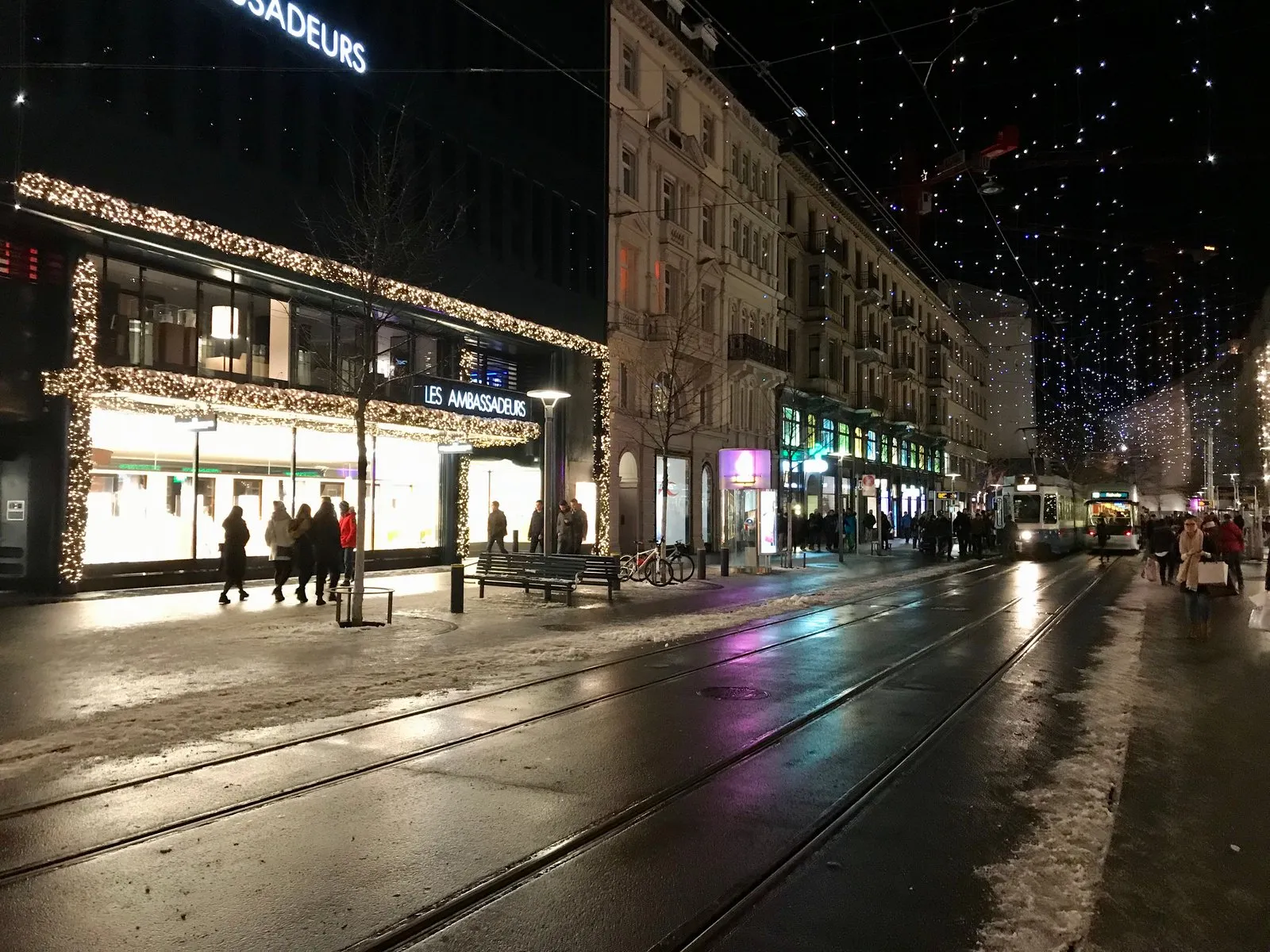 Bahnhofstrasse on a snowy winter evening. Photo: Ank Kumar, Wikimedia Commons, CC BY-SA 4.0.
Stop 2: Augustinergasse and Lindenhof (0.8 km – 1.3 km)
Turn left off Bahnhofstrasse into Rennweg, then immediately dip right into Augustinergasse—a short, narrow pedestrian lane famous for its painted wooden medieval bay windows (Erker) and cantonal flags strung overhead. Double back to Rennweg and climb the short cobbled steps up to Lindenhof.
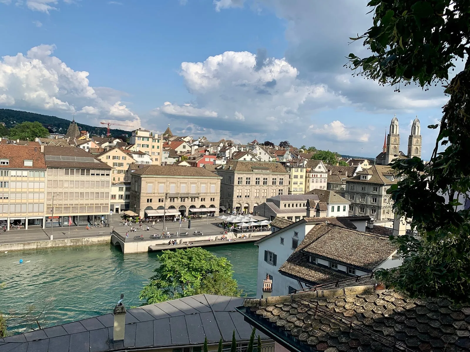
- Why pause here: This shaded plateau of lime trees marks the exact site of the Roman customs fortress of Turicum and later a Carolingian imperial palace. Locals play giant outdoor chess under the trees, and the stone parapet gives a free, unobstructed view straight across the Limmat towards the Rathaus, Niederdorf and Grossmünster.
- Bonus detour: Walk down the steep steps on the river side of Lindenhof into Schipfe, Zurich’s oldest surviving artisan quarter perched right at water level along the Limmat.
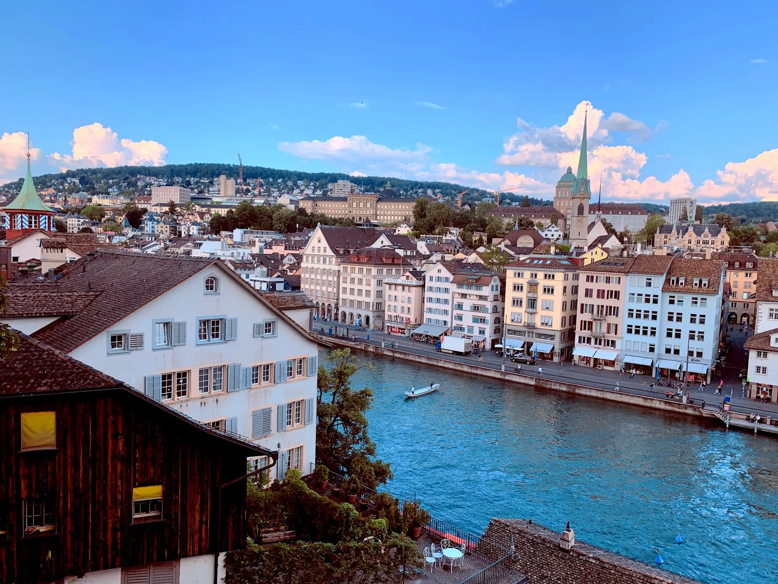 Zurich’s Old Town from Lindenhof terrace. Photo: Ank Kumar, Wikimedia Commons, CC BY-SA 4.0.
Stop 3: St Peter’s Church and Fraumünster (1.3 km – 1.8 km)
Exit Lindenhof on the south side and follow Pfalzgasse down to St.-Peter-Hofstatt, a quiet cobbled square fronted by St Peter’s Church and its 8.7-metre clock face—the largest church clock dial in Europe. Continue 200 metres south to Münsterhof, a wide pedestrian square bordered by historic guildhouses (including Zunfthaus zur Waag) and Fraumünster church.
Step inside Fraumünster (CHF 5, free under 16/students; opens at 12:00 on Sundays) to view Marc Chagall’s five stained-glass choir windows and Augusto Giacometti’s rose window. Full ticket and opening-hour details are in our Grossmünster and Fraumünster guide.
Stop 4: Paradeplatz and Confiserie Sprüngli (optional 5-minute loop)
Just two minutes west of Fraumünster lies Paradeplatz, Zurich’s tram hub and banking crossroads, anchored by Confiserie Sprüngli (founded 1836). Pop in for a small box of fresh Luxemburgerli (airy Swiss mini-macarons) to fuel the second half of your walk.
Stop 5: Münsterbrücke, Grossmünster and Niederdorf (1.8 km – 3.5 km)
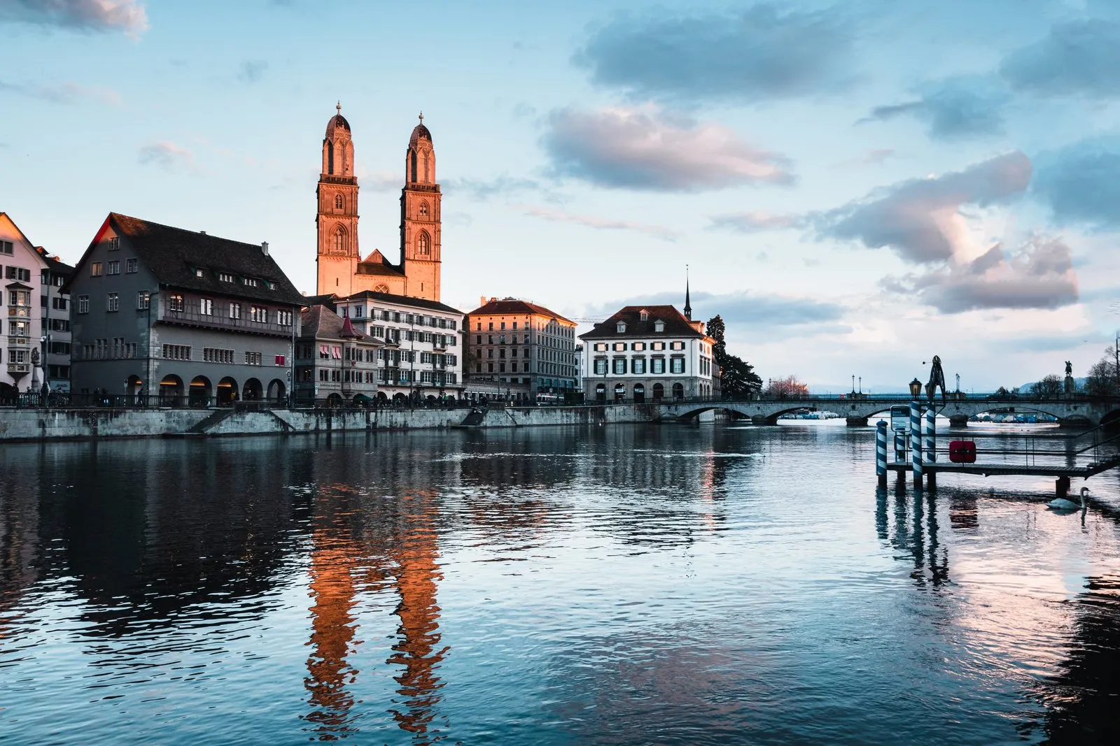
Cross the Münsterbrücke over the turquoise Limmat, pausing mid-bridge for classic shots looking south towards Lake Zurich and north down the river corridor. On the east bank stands Grossmünster (nave free; 187-step Karlsturm tower CHF 5, free with the Zürich Card).
From Grossmünster’s doors, turn north into Oberdorf and Niederdorf—the pedestrian medieval backbone of the right bank. Follow Münstergasse and Niederdorfstrasse past bookshops, independent boutiques, Cabaret Voltaire on Spiegelgasse (birthplace of the 1916 Dada art movement) and Hirschenplatz, emerging at Central square—where you can cross the Bahnhofbrücke directly back to Zurich HB in 4 minutes.
Prefer a guided version? Join the 2-hour Stories of the Old Town walking tourad or the Zurich City Essential Walking Tour with Polybahnad.
Part 2: Uetliberg mountain and the Felsenegg Panorama Trail
After finishing the Old Town (or on a separate clear morning), head to the underground SZU platforms (Gleis 21–22) at Zurich HB and board the S10 train marked Uetliberg.
| Leg | Transport / Trail | Time | ZVV Zone |
|---|---|---|---|
| Zurich HB → Uetliberg | S10 train (every 30 min) | 20 minutes | Zones 110 + 155 |
| Uetliberg station → Summit (871 m) | Paved uphill footpath | 10 minutes | On foot |
| Uetliberg → Felsenegg (Planetenweg) | Well-marked ridge trail (6 km) | 1.5–2 hours | On foot |
| Felsenegg → Adliswil | LAF aerial cable car (every 15 min) | 5 minutes | Zones 155 + 150 |
| Adliswil → Zurich HB | S4 train (every 10–20 min) | 15 minutes | Zones 150 + 110 |
1. Uetliberg Summit and Observation Tower
The S10 climbs steadily through suburban woods to Uetliberg station (814 metres), Europe’s steepest standard-gauge adhesion railway. Follow the wide, car-free gravel path uphill for 10 minutes to Uto Kulm (871 metres), where the summit hotel, beer garden and 72-metre steel lookout tower (Aussichtsturm) stand.
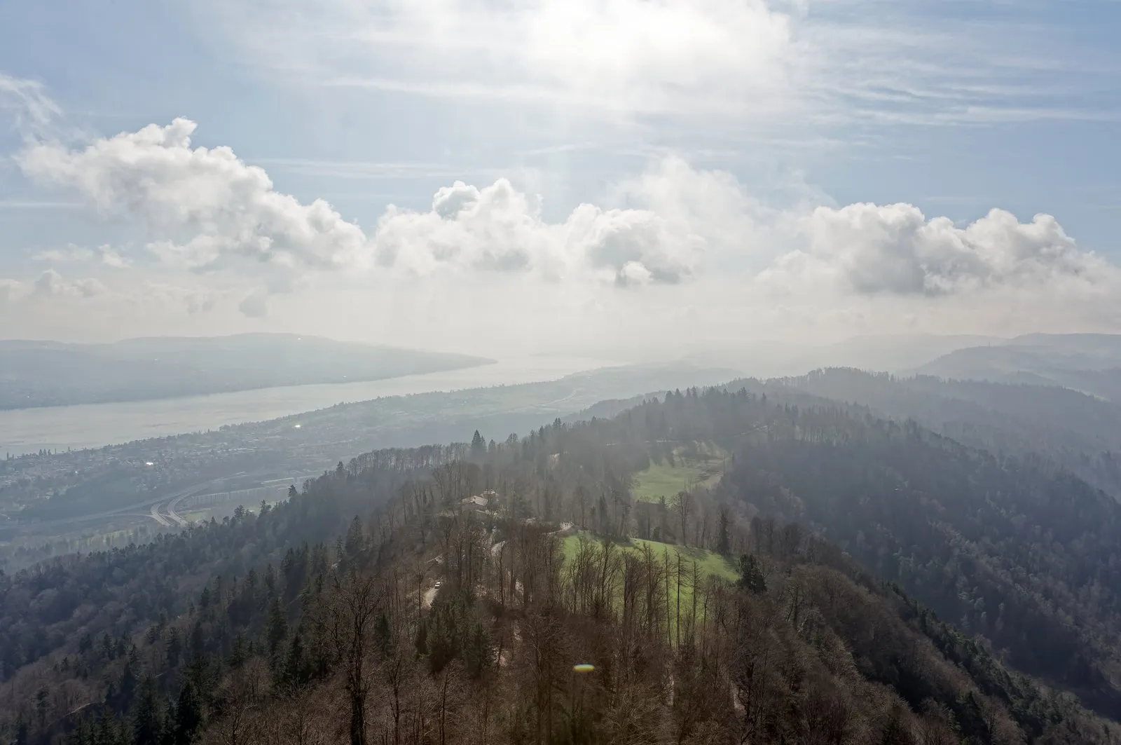
- Climbing the tower: Insert CHF 2 at the turnstile and climb the open metal stairs for a 360-degree panorama over central Zurich, the entire crescent of Lake Zurich, the Limmat valley and—on clear days—the snowy wall of the Bernese and Glarus Alps (including Eiger, Mönch and Jungfrau far to the southwest).
- Short-visit option: If you are short on time or travelling with small children, simply enjoy the summit view, have coffee or bratwurst at the Uto Kulm terrace, and ride the S10 straight back to Zurich HB (total round trip: 90 minutes).
2. The Felsenegg Panorama Trail (Planetenweg, 6 km)
To turn Uetliberg into Zurich’s finest half-day hike, follow the yellow Swiss hiking signposts south along the Albis ridge towards Felsenegg (marked 1h 45min).
- The Planet Trail concept: Every metre along the 6-kilometre ridge represents 1 million kilometres in our solar system. You start at the Sun sculpture near Uetliberg summit, pass Mercury, Venus, Earth and Mars within the first few minutes, then stride across wide gaps through beech woodland and sunlit clearings to reach Jupiter, Saturn, Uranus, Neptune and finally Pluto right at Felsenegg.
- Terrain and views: The trail is broad, well-maintained gravel and packed earth with gentle rolling climbs and descents (roughly 140 metres total elevation gain, 200 metres loss). Regular trainers or walking shoes are completely fine in dry weather; wear waterproof boots after heavy rain or in winter snow. Throughout the walk, breaks in the trees open sudden views east over Lake Zurich and west across the wooded hills towards Lucerne.
- Midway refreshment: Roughly halfway along the ridge, Restaurant Gmüetliberg and picnic benches with fire pits (locals grill Cervelat sausages here on weekends) offer natural rest stops.
3. Felsenegg Viewpoint and the Adliswil Cable Car (LAF)
At Felsenegg (804 metres), the ridge opens onto a sweeping terrace beside Restaurant Felsenegg—a reliable spot for a cold beer, rösti, apple strudel or cheese fondue overlooking the lake.
Two minutes from the restaurant stands the upper station of the Luftseilbahn Adliswil–Felsenegg (LAF), the only public aerial cable car in the Canton of Zurich.
- Frequency and ride: Cabins depart every 15 minutes (usually at
:05,:20,:35,:50, check the ZVV app for exact evening last-car times, typically around 22:00–23:00). The 5-minute glide drops 300 vertical metres over treetops into the Sihl Valley town of Adliswil. - Ticket note: Do not buy a separate tourist cable-car ticket—your ZVV multi-zone ticket (Zones 110 + 150 + 155), Zürich Card or Swiss Travel Pass scans directly at the cable-car gate.
- Return to Zurich HB: From the Adliswil valley cable-car station, follow the clearly signed 8-minute downhill footpath through the residential street to Bahnhof Adliswil, then board the S4 train directly back to Zurich HB underground platforms (15 minutes).
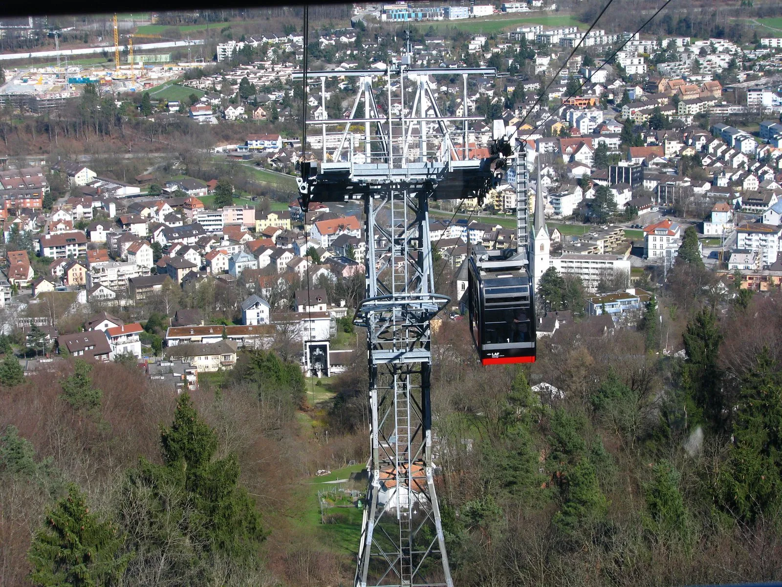 The Adliswil–Felsenegg cable car. Photo: Roland zh, Wikimedia Commons, CC BY-SA 3.0.
Practical hiking and weather tips
- Check the summit webcam first: In autumn and winter, Zurich can sit under grey Hochnebel (high valley fog) while Uetliberg bakes in blue-sky sunshine above the clouds—or vice versa. Check the live Uetliberg webcam before heading up so you know whether to expect Alpine panoramas.
- Water and toilets: Free public drinking fountains (safe, cold Alpine water) line both the Old Town walk and Uetliberg summit. Public toilets sit at Zurich HB, Lindenhof (nearby), Uetliberg station, Uto Kulm and Felsenegg cable-car station.
- Direction flexibility: You can also walk the ridge in reverse—taking the S4 to Adliswil and riding the cable car up to Felsenegg before walking north to Uetliberg—though starting at Uetliberg means you walk slightly downhill overall and finish with the dramatic cable-car descent.
- Next steps: Refuel after your hike with our where to eat in Zurich or Zurich food tours and fondue guides, or plan bigger Alpine peaks with our day trips from Zurich and Mount Pilatus day trip.
Common questions
How do I get from Zurich HB to Uetliberg?
Take the S10 S-Bahn train (operated by SZU) from underground platforms 21–22 at Zurich HB directly to Uetliberg terminus (20 minutes, every 30 minutes). From Uetliberg station, it is a 10-minute uphill walk on a paved path to the summit hotel and observation tower.
Does the Zürich Card cover the S10 train to Uetliberg and the Felsenegg cable car?
Yes. Both the S10 train to Uetliberg and the Luftseilbahn Adliswil-Felsenegg (LAF) cable car down to Adliswil, plus the S4 return train to Zurich HB, are fully integrated into the ZVV transit network and covered by the Zürich Card and Swiss Travel Pass.
How long is the Uetliberg to Felsenegg Panorama Trail?
The ridge trail (also known as the Planetenweg or Planet Trail) is 6 kilometres long and takes 1.5 to 2 hours at a comfortable walking pace. It follows wide, well-signposted gravel and forest paths with gentle undulations rather than steep alpine climbs.
Can you walk the Zurich Old Town route and hike Uetliberg on the same day?
Yes. Walk the 3.5-kilometre Old Town loop in the morning (2 to 2.5 hours including church stops), have lunch near Bahnhofstrasse or Zurich HB, then catch the S10 train up to Uetliberg in the afternoon for the Felsenegg ridge walk and sunset views.
Does the Uetliberg observation tower cost money to climb?
Yes, the 72-metre steel lookout tower (Aussichtsturm) beside Hotel Uto Kulm has a small turnstile fee of CHF 2 (coins or contactless payment). The surrounding summit terrace is completely free.
Is the Felsenegg trail open in winter?
Yes. The S10 train, the ridge path and the Adliswil-Felsenegg cable car run year-round. In winter, Uetliberg often sits above Zurich's valley fog layer in bright sunshine; wear grippy boots if snow or frost is on the trail.