In this guide
💡 The Short Version: Acqua alta is high water in the lowest streets of Venice. Piazza San Marco starts to flood at about +80 cm; at +110 cm 12% of the city’s walking surface is under water and at +140 cm 59%. The MOSE barrier is raised when the forecast shows a tide above +110 cm: it was raised 49 times in 2025 to 2026, against 23 the season before. Sirens sound about three hours ahead for +110 cm or more, and raised walkways go up from 15 September to 30 April. The season is October to March, with November the peak. Or book a walk: the City Highlights Walking Tour with a Local Guidead is from €24 for 2 hours.
When it floods
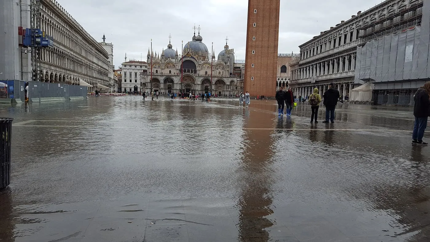
St Mark’s Square under water at acqua alta. Photo: Javier Valero Iglesias, Wikimedia Commons, CC BY-SA 2.0.
All heights are in centimetres above the Punta della Salute datum, the zero that every tide sign in the city uses. The Comune’s tide centre prints the share of the city’s public walking surface that is under water at each height (Comune di Venezia).
| Tide | Walking surface under water |
|---|---|
| +80 cm | The lowest ground in Piazza San Marco starts to flood |
| +90 cm | 2% |
| +100 cm | 5% |
| +110 cm | 12% |
| +120 cm | 28% |
| +130 cm | 46% |
| +140 cm | 59% |
| +150 cm | 70% |
| +160 cm | 77% |
| +180 cm | 85% |
The season is autumn and winter. The Comune’s 2009 study, quoted by Visit Venice, puts about 75% of events in October, November and December, with November the peak, and records none in July or August. It also finds that the high tides of the flood season cluster in the morning, and that none has been recorded in the early afternoon, so the walk to San Marco is the part of the day worth checking a forecast for.
The MOSE barrier
MOSE is the set of mobile gates at the three lagoon inlets, Lido, Malamocco and Chioggia. The Autorità per la Laguna di Venezia raises them when the forecast shows a tide above 110 cm. Its log counts the closures by season:
| Season | Closures |
|---|---|
| 2020 to 2021 | 20 |
| 2021 to 2022 | 13 |
| 2022 to 2023 | 19 |
| 2023 to 2024 | 32 |
| 2024 to 2025 | 23 |
| 2025 to 2026 | 49 |
The 2025 to 2026 count covers the log from September 2025 to mid-May 2026. Thirty of the closures fell between 28 January and 20 February 2026, in an abnormal series of events that the Authority re-analysed afterwards. Visit Venice, citing the Authority and ISPRA, says the historic centre recorded no tide of 110 cm or more in 2025, against 7 measured out at sea. Visit Venice adds that while the gates are up, boats through the inlets stop and the lines to the Lido can be diverted.
The alerts
The Comune’s tide centre issues the forecast and the bulletin (Centro Previsioni e Segnalazioni Maree).
- Telegram. The bot @centromareevenezia_bot gives forecasts and live levels, and the channel Centro Maree Avvisa sends alerts for high-water events.
- E-mail. A bulletin in English or Italian.
- SMS. Text MAREA to 342 4141041. You pay for the request, and the reply is free.
- Sirens. 23 sirens, 15 in the historic centre, 3 on islands and 5 on the Lido coast, usually sound about three hours ahead for a tide of +110 cm or more. A four-level signal follows to show the expected height.
The raised walkways
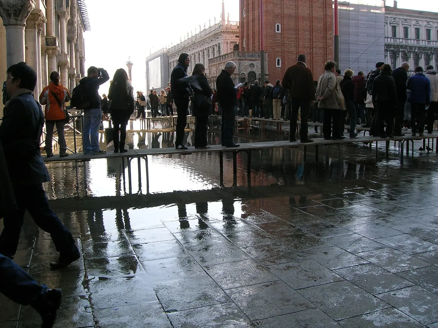
Visitors on a raised walkway across the flooded Square. Photo: Giovanni.mello, Wikimedia Commons, CC BY-SA 3.0.
From 15 September to 30 April the city lays raised walkways, the passerelle, along set routes. They are built for tides up to about +120 cm, and above +120 cm some routes cannot be used. The Comune’s page has the routes by sestiere (Percorsi su passerelle).
What it does to a day
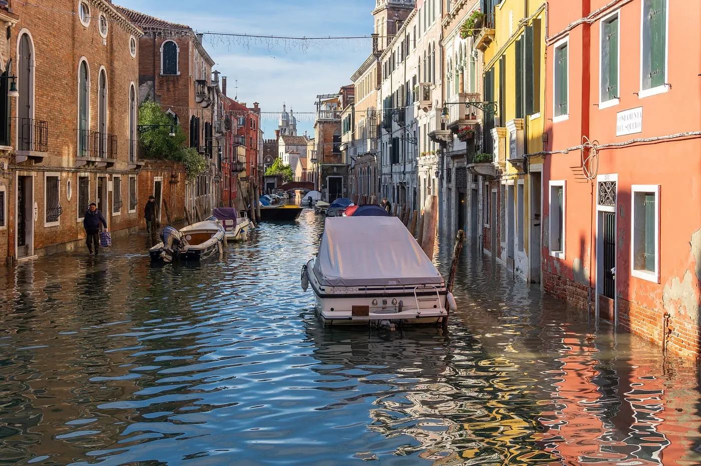
Fondamenta del Squero under water at acqua alta. Photo: Marco Ober, Wikimedia Commons, CC BY-SA 4.0.
- St Mark’s Basilica. The narthex floods first, and the Procuratoria sets alternative routes on the day: see St Mark’s Basilica tickets.
- The Libreria Acqua Alta. The staircase of books and the gondola of books close in rain and at high or low tide.
- The Square. It is the lowest ground in the city, and the flooding starts there: see hotels near St Mark’s Square.
- Your feet. The walkways are built for tides up to about +120 cm, so wear waterproof boots for a morning walk on a flood day.
Planning round it
The flood season is also the quiet season: see the best time to visit Venice for the weather and the crowds by month. Where to stay in Venice compares the areas, and Venice Carnival 2027 falls in the winter: in 2026, 30 of the season’s closures came between 28 January and 20 February. Venice in one or two days and what to book before you go to Venice fit the sights into days, and Venice public transport covers the boats that divert when the gates are up.
Common questions
What is acqua alta?
High water: the tide rises above the lowest streets and squares of Venice, starting with Piazza San Marco. Heights are quoted in centimetres above the Punta della Salute datum, and the Square starts to flood at about +80 cm.
When does Venice flood?
Mostly from October to March. The Comune's 2009 study, quoted by Visit Venice, puts about 75% of events in October, November and December, with November the peak, and none ever in July or August.
What is MOSE?
The mobile gates at the three lagoon inlets, which are raised when the forecast shows a tide above +110 cm. The Autorità per la Laguna logged 49 closures in the 2025 to 2026 season, from September 2025 to mid-May 2026, against 23 the season before.
How do I know when a high tide is coming?
Sirens sound about three hours before a tide of +110 cm or more, followed by a four-level signal that shows the expected height. The Comune's tide centre sends alerts by Telegram, by e-mail bulletin in English or Italian and by SMS.
Are there raised walkways?
Yes, from 15 September to 30 April, along set routes, built for tides up to about +120 cm. Above +120 cm some routes cannot be used.
Does St Mark's Basilica close for acqua alta?
The narthex, the entrance porch, floods first, and the Procuratoria sets alternative routes on the day, according to its access rules.